
Ślęża
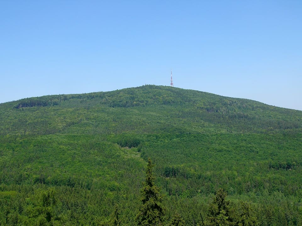
A mountain of 718 m that rises by itself out of flat country at Sobótka, southwest of Wrocław, with a church, a tourist house and an observation tower on its summit.
Three ways from Wrocław
The map traces three ways out of Wrocław to the massif: the Koleje Dolnośląskie train to Sobótka and Sobótka Zachodnia, the road to the main car park at Przełęcz Tąpadła and, on summer weekends, the bus by Sobótka and Sulistrowiczki to the pass. Press play, or choose one way to see it alone. The table under the map gives the length and time of each.
Map data © OpenStreetMap contributors, under the ODbL: the rail line, roads, river, forest, stations and the bus stop. The car and bus roads are routed with OSRM on OpenStreetMap data.
| Way | Length | Time |
|---|---|---|
| Train | About 38 km by rail to Sobótka, 41 km to Sobótka Zachodnia | About 35–55 min to Sobótka |
| Car | About 44 km by road to the car park | About 50 min without traffic |
| Bus, summer weekends | About 45 km by road to the pass, 36 km to Sobótka | About 45–55 min to Sobótka. The summer run on to the pass adds a stretch whose time is not given here. |
What it is
Ślęża rises to 718 m above sea level, by itself out of flat country, southwest of Wrocław. It is the highest point of the Sudeten Foreland (Przedgórze Sudeckie) and of the Ślęża Landscape Park (Ślężański Park Krajobrazowy), which was created in 1988. The summit is a nature reserve, and the mountain is on the Crown of Polish Mountains (Korona Gór Polski) list.
Why people go
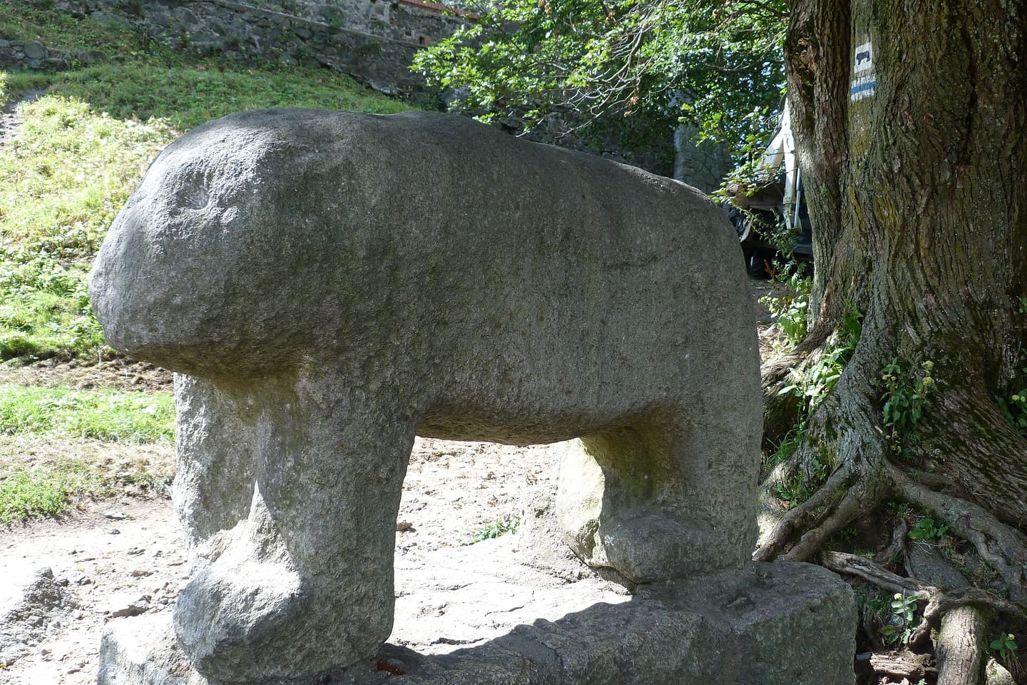
For centuries Ślęża was held to be a holy mountain, a place of pagan worship. Remains of carved stone cult figures and stone circles survive on and around it, and an ancient cult sculpture of a bear stands at the top.
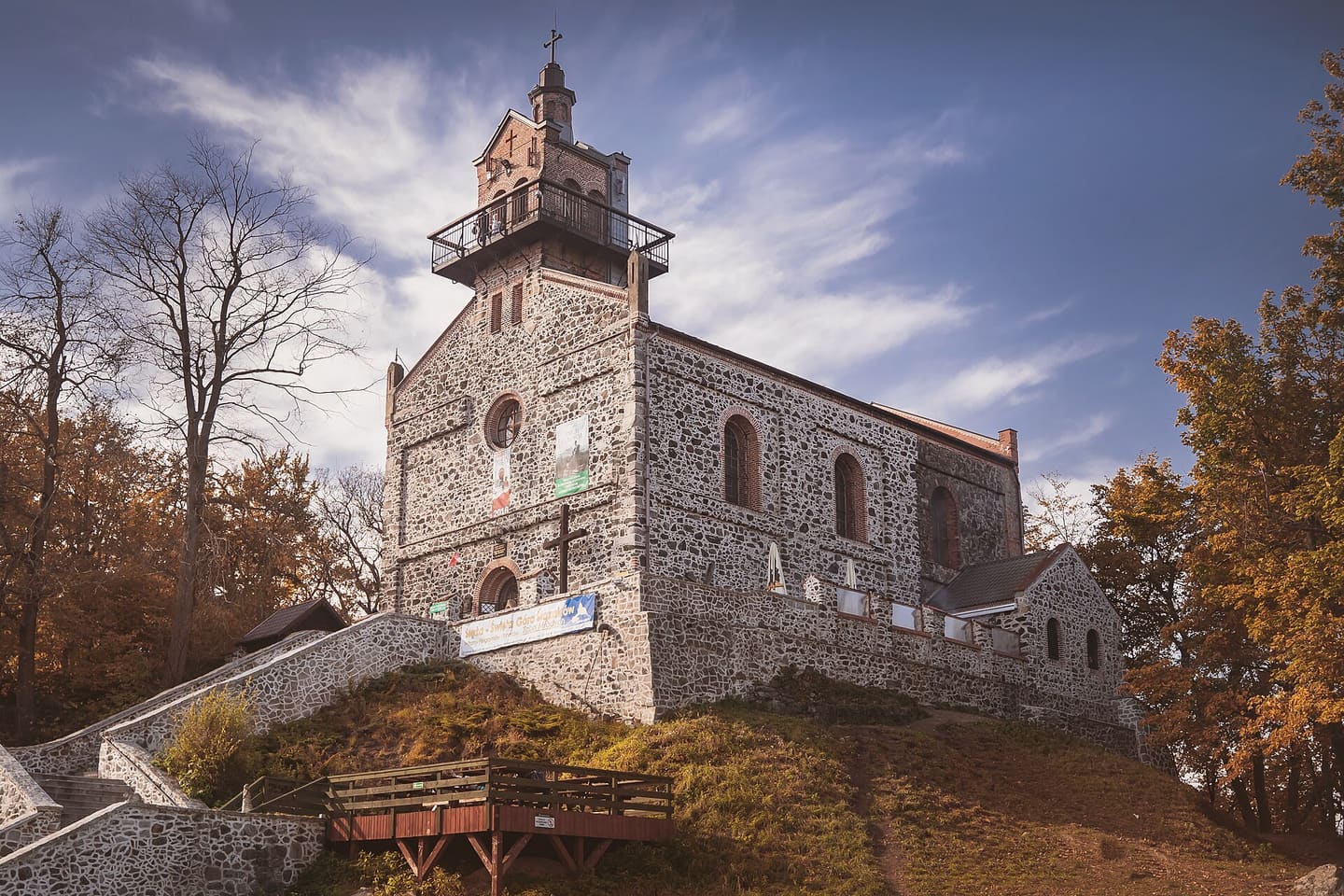
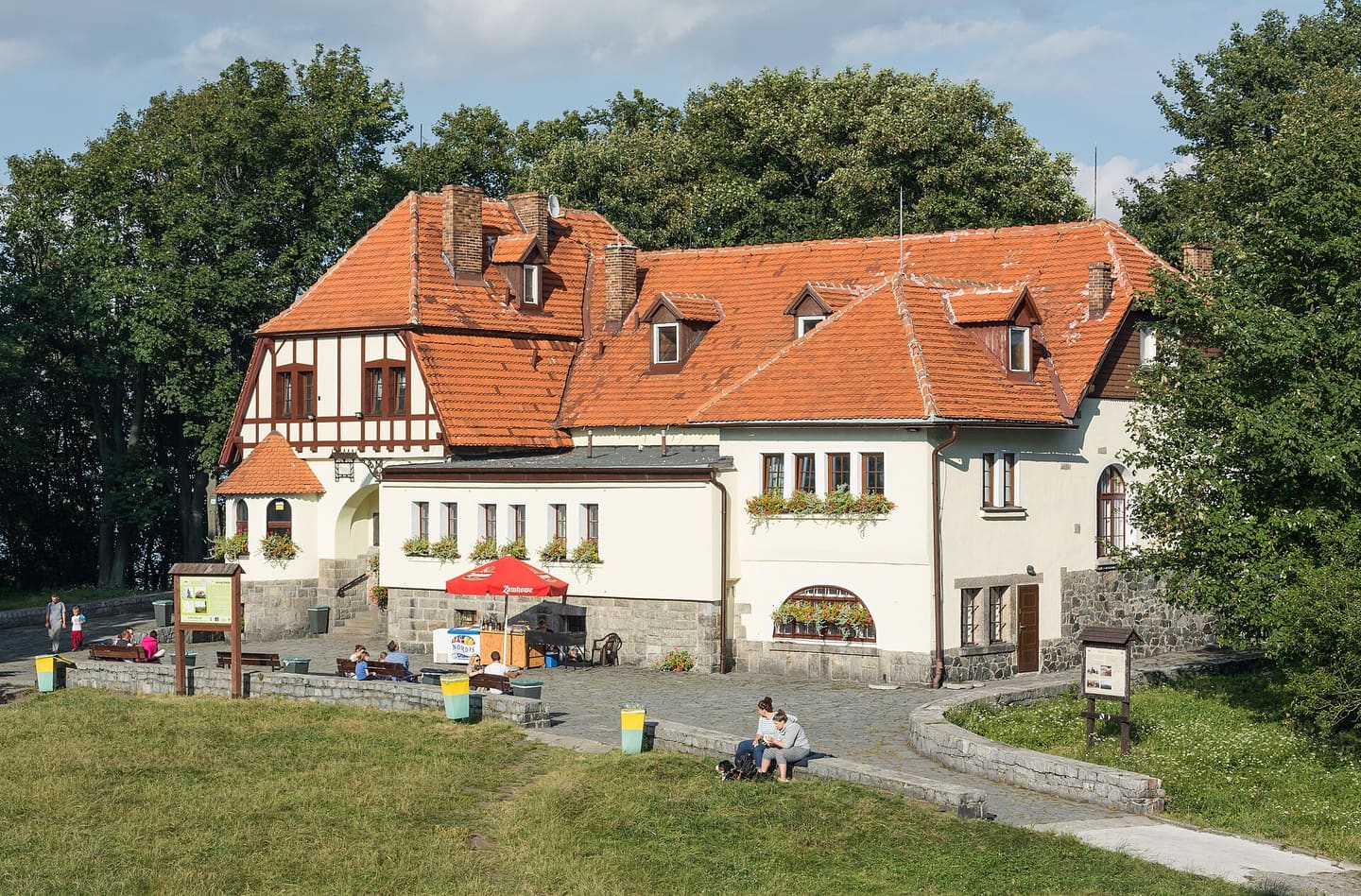
The summit also has the church of the Visitation of the Blessed Virgin Mary, the PTTK tourist house (Dom Turysty), an observation tower and a television and radio mast. From the top the view takes in the Karkonosze.
Trails to the top
Six marked trails reach the summit church: from Sobótka and Sobótka Zachodnia stations, from the Przełęcz Tąpadła pass and from Sulistrowiczki. The map draws them from OpenStreetMap on the mountain’s terrain. Press play to walk one; drag to look around.
The 3D map needs WebGL, which this browser has turned off. The list of trails below has every route.
Map data © OpenStreetMap contributors, under the ODbL: trails, roads, forest, stations and the car park. Walks from the stations routed with OSRM on OpenStreetMap data. Terrain: Terrarium elevation tiles (Mapzen, AWS Open Data), height 1.5×. Drawn with MapLibre.
- Walked
- 0 km
- Height
- —
- Climbed so far
- +0 m
- Gradient here
- —
- Main car park, Przełęcz Tąpadła
- Railway station
- Walk from a station to a trail
-
Yellow from Przełęcz Tąpadła
From Przełęcz Tąpadła to the summit church.
3.0 km · +316 m climb · −10 m descent
No station at the start; Sobótka station is 8.7 km away on foot.
-
Blue via Skalna Perć
From Przełęcz Tąpadła to the summit church.
4.6 km · +371 m climb · −71 m descent
No station at the start; Sobótka station is 8.6 km away on foot.
-
Red from Sobótka
From Sobótka station to the summit church. The sources on this page give 5.2 km for the red trail from Sobótka; the marked line from the station measures longer.
6.1 km · +530 m climb · −10 m descent
From Sobótka station: 180 m on foot to the start.
-
Yellow from Sobótka via Wieżyca
From Sobótka station to the summit church.
6.1 km · +552 m climb · −32 m descent
From Sobótka station: 180 m on foot to the start.
-
Red from Sulistrowiczki
From Sulistrowiczki to the summit church.
3.8 km · +464 m climb · −18 m descent
No station at the start; Sobótka station is 7.8 km away on foot.
-
Blue from Sobótka Zachodnia
From Sobótka Zachodnia station to the summit church.
5.6 km · +528 m climb · −9 m descent
From Sobótka Zachodnia station: 430 m on foot to the start.
Sanctuary of Our Lady of Good Counsel
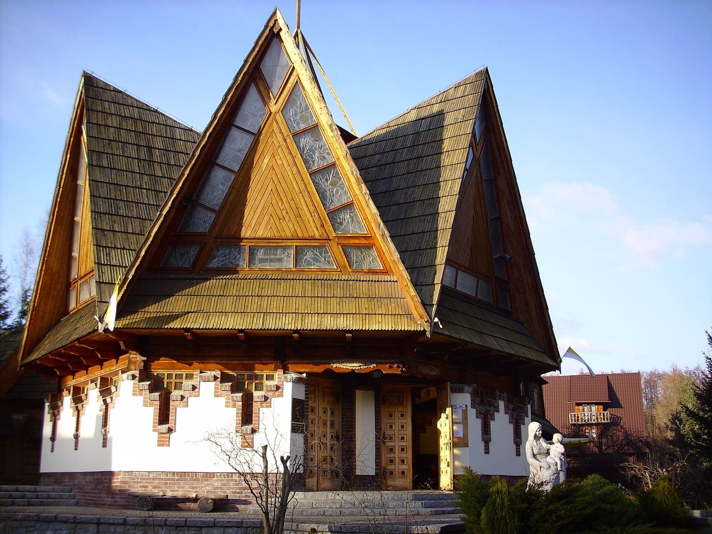
In Sulistrowiczki, a village in the Ślęża massif where the red trail on the map above begins, stands a small wooden church built in 1999: the sanctuary of Our Lady of Good Counsel. It belongs to the parish of Sulistrowice, and in 2017 Archbishop Józef Kupny of Wrocław made it a diocesan sanctuary.
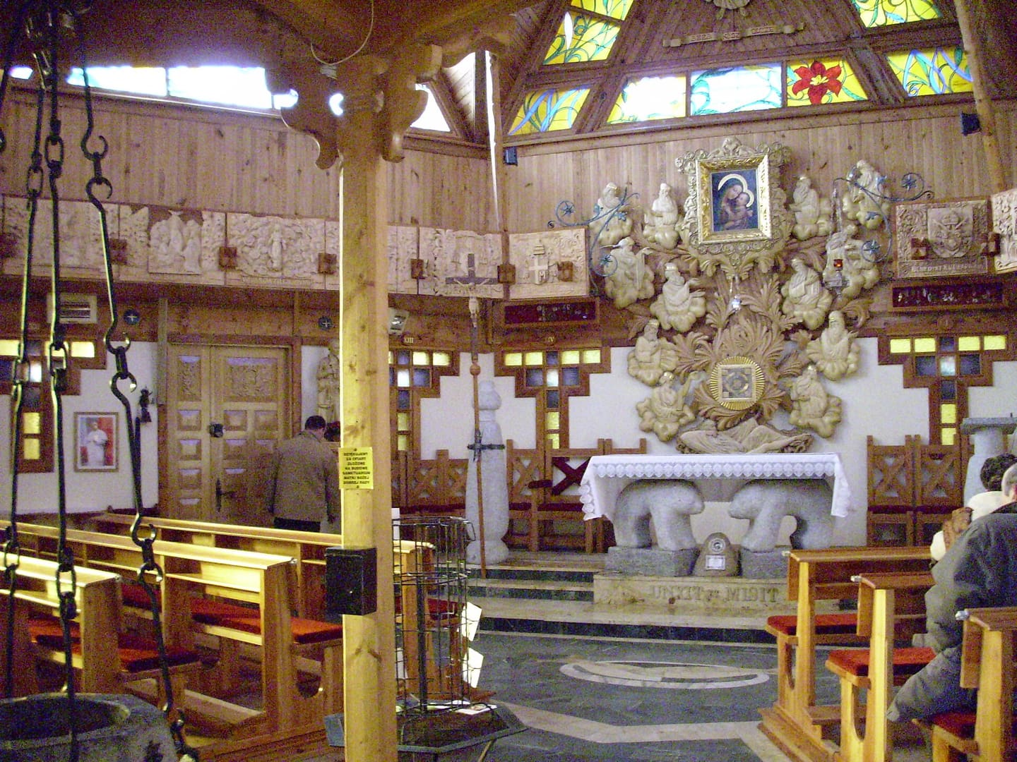
The church is a regular heptagon of spruce wood, its roof shaped like a seven-pointed star, for the seven gifts of the Holy Spirit. Inside, two granite bears hold up the altar, a reference to the old symbolism of Ślęża, and the stained glass shows flowers from the Sulistrowice meadow nearby. A marble figure of Our Lady of Good Counsel stands in front of the church, and close by is a spring known as St Świerad’s Well.
Getting there from Wrocław
Koleje Dolnośląskie (KD), the regional railway, runs trains from Wrocław Główny through Sobótka to Świdnica. Sobótka is the town at the foot of the mountain; Sobótka Zachodnia is the next stop. In summer, buses from Wrocław also run on weekends to the Przełęcz Tąpadła pass.
Marked trails to the summit start in Sobótka and at the pass. The red trail from Sobótka is 5.2 km and takes about two hours. Yellow and blue trails also start in Sobótka, and a yellow and a blue one at the pass; the sources give different lengths for them, so this page gives none.
The same railway line goes on to Świdnica. More on regional trains is on the trains page.
Links
- Koleje Dolnośląskie: timetables (in Polish) kolejedolnoslaskie.pl
- Sobótka commune: the Ślęża Massif (in Polish) sobotka.pl
- The Ślęża Landscape Park, from the park authority (in Polish) dzpk.pl
- The city’s article on mountains reached from Wrocław by train, with Ślęża (in Polish, 2022) wroclaw.pl
- Sulistrowice parish: the sanctuary in Sulistrowiczki (in Polish) parafiasulistrowice.pl